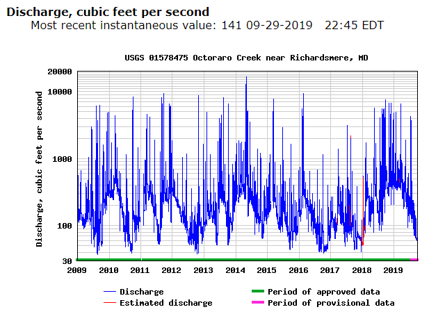
The Octoraro creek will fluctuate during the year with the amount of discharge that is produced. Fall and spring seem to be some of the highest discharge periods out of the year, showing that precipitation in this region is greater during these seasons. Summer being a dryer part of the year with less precipitation tends to be the lowest point, and winter months are moderate with a tendency of increasing towards spring. Soure: https://waterdata.usgs.gov/md/nwis/uv/?site_no=01578475&PARAmeter_cd=00065,00060,62620,00062,00054 The height of the creek parallels the discharge graph with seasonal precipitation variations. The severe spikes in height are most likely from hurricanes or tropical storms that have hit the watershed. This will usually cause roads to be flooded out and damage to bridges as well as residential properties in the flood plain. Source: https://waterdata.usgs.gov/md/nwis/uv/?site_no=01578475&PARAmeter_cd=00065,00060,62620,00062...

